Posts

Across the Great Smoky Mountains National Park, miles of interconnected trails meander through lush, green valleys, hug the banks of moss-laden, rocky creeks, and climb through thickets of mountain laurel and rhododendron to the blue-tinged mountain peaks.

You could spend weeks backpacking through this rich landscape, but a weekend trip will also allow you to experience the best of the Smokies. To help you plan your visit, we’ve highlighted three backpacking loops that give you the Appalachian Trail, streamside and ridgeline campsites, killer views, and enough distance and elevation to satisfy your inner weekend warrior.

Big Creek Loop

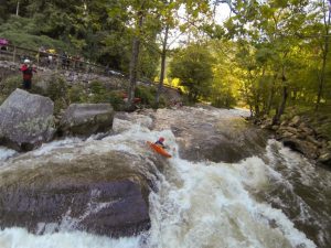
Combining the best of front-country and backcountry camping, the Big Creek area on the northeastern tip of the park off I-40 offers something for every level of hiker. Tackle a 21.5-mile loop over big peaks or lower your mileage and elevation with a night at one of the sweetest creekside campsites in the park. Either way, you’ll hike the AT through some of the most scenic terrains in the Smokies.

You will be in constant awe of the beauty on Big Creek Loop.
Rock/Creek

Roll into Big Creek Friday night to enjoy campground amenities like restrooms, dinner at a picnic table, and campsites with fire rings. You’ll be up early on Saturday to climb the Chestnut Branch Trail 2 miles to the Appalachian Trail. One of the shortest AT access points, the trail passes the remains of homesteads that pre-date the national park.

Turn south on the AT and continue climbing 3.3 miles to the 0.6-mile Mt. Cammerer fire tower spur trail. At 4,928 feet, the tower overlooks the Pigeon River Gorge to the north and Mt. Sterling to the south. From the fire tower, it’s a moderate descent 2.1 miles to the Low Gap Trail. Take Low Gap 2.5 miles to campsite #37 at the Big Creek Trail junction. Right on the banks of Big Creek, you’d be hhard-pressedto find a more spacious backcountry site in the park.

On Sunday, you can go big or go home, as they say. Going big means a hike up the Swallow Falls Trail 4 miles to the Mt. Sterling Ridge Trail. It’s another 1.4 miles and more climbing to an elevation of 5,842 feet on Mt. Sterling. Climb Sterling’s 60-foot steel fire tower for panoramic views of Cataloochee Valley, the Black Mountains, and the Southern Appalachians. Now, the downhill endurance test begins, with a 4,000-foot elevation loss over 6 miles on the Baxter Creek Trail. If you opt to go home, you can sleep in, savor your coffee by the campfire, and still have plenty of time to hike the moderate, 5-mile descent along Big Creek back to the campground, passing two stunning waterfalls and plenty of swimming holes along the way.

Big Creek loop ends with a 4,000-foot elevation loss over 6 miles on the Baxter Creek Trail.
virgntn2011

Big Creek Campground is open from April through October and makes a great base camp for groups by serving a wide variety of abilities and interests. On your way home, make sure you leave enough time to refuel at Carver’s Apple Orchard in Cosby, Tenn. At Carver’s you can shop for fresh produce at the farmers market, nab awesome treats at an old-time candy shop, and feast at a homestyle restaurant, where the apple fritters are not to be missed.

Twentymile Loop

In the southwest corner of the Smokies, you’ll find a lesser-used trailhead that leads to the AT and one of the most scenic balds in the park. From this trailhead, you’ll log 17.6 miles on the way to Gregory Bald, sleeping one night on the AT and camping the other night on the bald.

Start off Friday afternoon at the Twentymile Ranger Station off Highway 28 near the border of North Carolina and Tennessee. A non-technical climb takes you 4.5 miles to meet the AT at Sassafras Gap. Campsite #113, at Birch Spring Gap, is less than 1 mile north of the trail junction. If time allows late Friday or early Saturday morning, head south on the AT for 360-degree views at sunset or sunrise from the top of Shuckstack Fire Tower. The historic lookout isn’t regularly maintained, so watch your step on the 200-foot climb to the top.

In the southwest corner of the Smokies you’ll find the lesser-used Twentymile Loop trailhead.
Chris M Morris

You’ll resume your northward journey on the AT, traveling 2 miles over Doe Knob to the next trail junction. Next, take Gregory Bald Trail west a little more than 3 miles to campsite #13 on the bald. Known for spectacular flame azalea blooms each year in mid to late June, the grassy high-elevation meadow offers stunning views of Cades Cove, Fontana Lake, and Clingmans Dome.

On Sunday, make the final 6.3-mile descent to the trailhead on the wide, non-technical Wolf Ridge Trail. Refuel at Fontana Village, just over 6 miles down Highway 28, before heading home. Burgers and brews will hit the spot at Wildwood Grill, while the Mountainview Restaurant highlights seasonal produce, along with fresh, local rainbow trout.

Deep Creek Loop

Along Deep Creek loop you’ll pass Indian Creek Falls.
Alan Cressler

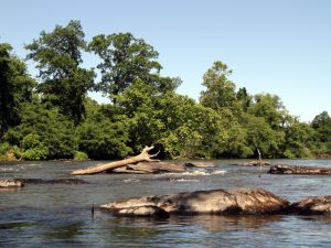
Enjoy the streams and waterfalls of the Deep Creek area in the south-central region of the Smokies on this 28.2-mile loop. You’ll also spend a night in an AT shelter and exit on one of the longest continuously descending trails in the Smokies.

You’ve barely left the Deep Creek Ranger Station before you come across Tom Branch Falls and Indian Creek Falls. Once you pass these Insta-worthy stops, it’s a slight uphill grade for 4 miles along the moderately rocky Deep Creek Trail to campsites 54-59. Claim a site for Friday evening (all but one are non-reservable) to enjoy the refreshing waters of Deep Creek and thickly wooded campsites.

Creek crossings and easy bushwacking are on the agenda Saturday, as you hike another 4 miles to the Fork Ridge Trail. Fork Ridge ascends 5 miles to Clingmans Dome Road and the AT. A short hike north takes you to the Mount Collins shelter, where you’ll spend the night in a high-elevation spruce-fir forest and dramatically cooler, drier conditions. Enjoy the shelter amenities, like cozy bunks and a fireplace inside.

Hike down from Clingmans Dome Road to start your final 11.4-mile descent.
Kevin Stewart Photography

The pre-dawn hike south to Clingmans Dome is highly recommended for 360 degrees of sunrise from the highest point in the Smokies. Hike 2 miles down Clingmans Dome Road to the Noland Divide Trailhead to start your final 11.4-mile descent. The trail slopes gently for the first 5 miles before making a steeper drop into Deep Creek, but there are few roots and rocks to slow you down. Make sure you stop to enjoy the views at Lonesome Pine Overlook along the way.

After logging all those miles, nothing’s going to taste more satisfying than a meal and craft beer at The Warehouse at Nantahala Brewing Co. Wrap up your Smokies adventure on the outdoor patio in downtown Bryson City with specialties like the slow-cooked brisket noodle bowl, apple bourbon pork chops, or Bryson City Brown Ale chicken along with a flagship or seasonal draft.

JOIN OUR NEWSLETTER

Featured image provided by Kevin Stewart Photography

The French Broad is one of the world’s oldest rivers and one of the most important natural assets in Western North Carolina. In 2012, the 140-mile-long French Broad River paddle trail was completed, improving recreational access with eight paddle-in-only campsites every 12 to 15 miles. Environmental nonprofit MountainTrue developed and oversees the trail and is home base for Riverkeeper Hartwell Carson. Each year the group hosts the French Broad Riverkeeper Float, a multi-day river adventure guided by Carson for fun and education on the river and the environmental issues surrounding it. MountainTrue provides boats for those who don’t have them and supplies all meals; just show up with a tent, jump in a boat and you’re off.

Boaters on the French Broad, Courtesy of Joanne Sullivan
Boaters on the French Broad (Courtesy of Joanne Sullivan)

The trip’s support team arrives at each stop in advance and gets meals set up and takes care of breakfast in the morning, too. The trip attracts people of all ages (kids are welcome) and it’s designed to be easy enough for newbies to paddling.

What sets the trip apart from solo adventures is the opportunity to get a behind-the-scenes look with the person who probably knows more about the river than anyone else. Carson has been the French Broad Riverkeeper for years, immersed in its ecological and political issues. Participants in the float learn about the effects that a industrial plants along the river have on water quality and may do a water sample along the way.

Paddling the French Broad Paddle Trail, Courtesy of Save the Float

Paddling the French Broad Paddle Trail (Courtesy of Save the Float)

The Float includes a paddle through Biltmore, as well as stretches of flat water, rural, urban, and remote parts of the river. There are small areas of class II and III rapids along the route, but nothing too challenging. There’s no shortage of outfitters along the French Broad, but the Float offers a unique experience that combines education, fun, and food along the water.

JOIN OUR NEWSLETTER


Featured image provided by David Wilson

The Nantahala River is ideally set up for intermediate paddlers. It has myriad small surf waves, forgiving eddy lines, and rapids with just enough power to challenge and entertain. There is also the capability to set up elite slalom courses through Nantahala Falls and the playhole near NOC has been tweaked through the years, hosting the Freestyle Kayaking World Championships in 2013. Combine those resources with the class IV-V options upstream and it’s easy to see why this area continues to be such a strong paddling destination.

What Makes It Great

Sections

Cascades | 0.7 miles | Class IV-V 

The Cascades are a very high quality and easily-lapped series of drops. The river channels well, allowing for a wide range of runnable flows (and some big holes at high water). Since this is a dewatered section of the Nantahala River, the Cascades run only when Whiteoak Creek is high from rain or during one of a few scheduled releases per year.

Upper Nantahala | 3.1 miles | Class III+ 

This is a scenic and busy section of river that provides a great cool down from the Cascades upstream or a way for aspiring advanced paddlers to get accustomed to more continuous whitewater. The entire section is road-scoutable, so watch out for wood. As far as flows go, the same thing applies as the Cascades. There needs to be rain or a scheduled release.

Nantahala Gorge | 7.5 miles | Class II-III 

The gorge section is also road-scoutable from nearly top to bottom and provides a beautiful and stress-free way to get into the world of whitewater. Notable rapids include Patton’s Run (right off the bat), Delebar’s Rock, Whirlpool, Quarry, Surfing Rapid, The Bump, and Nantahala Falls. The Falls represents an intimidating class III benchmark for many intermediate paddlers and the rocks are always lined with photographers and throwbags on a summer day.

Unique Experiences

Jump Rock 

About 5.5 miles into the run, you’ll see a very obvious large rock on the right (about 10 feet out of the water). It’s a great pit stop to jump or launch boats off of into the invigorating water.

SUP Surfing 

There are several great SUP surf waves on the Nantahala. The two best include one directly below the pedestrian bridge on NOC’s campus and another about two miles upstream at Surfer’s Rapid.

Eat at River’s End 

This restaurant is right next to the takeout and provides a nice après atmosphere to grab food and reflect on the day.

Directions, Parking, & Regulations

Access

Gorge Takeout

Nantahala Outdoor Center
13077 W. Hwy 19, Bryson City, NC 28713 

Gorge Put In 

Drive upstream on Hwy 19 ~7 miles
Turn L onto SR 1442/Wayah Rd.
Large USFS paved lot on left.

Upper Takeout 

Drive upstream on Hwy 19 ~7 miles
Turn L onto SR 1442/Wayah Rd.
Large USFS paved lot on left.

Upper Put In 

Continue on SR 1442/Wayah Rd. upstream for 3.3 miles.
Park at the 5th Bridge (if you hit Cascades, you’ve gone too far).

Cascades Takeout 

Continue on SR 1442/Wayah Rd. upstream for 3.3 miles.
Park at the 5th Bridge (if you hit Cascades, you’ve gone too far).

Cascades Put In

Continue on SR 1442/Wayah Rd. upstream for <1 mile.
You will see all of the drops; park at the top of the action (if you hit Whiteoak Creek, you’ve gone too far).

Important Info

JOIN OUR NEWSLETTER

Featured image provided by Malcolm Smith

Image for Nantahala River White Water Paddling

The Green River is a place that has had a large influence on the world of whitewater paddling and on many boaters’ lives. It is a highly convenient run because of its proximity to Asheville, Greenville, Charlotte, and Atlanta. Since it is a dam-released river, it also runs 300+ days a year.

Add the fact it has three sections of varying difficulties (and one of the most famous and prestigious extreme races) and you start to see why it is beloved by so many. But the truly beautiful thing about the Green is the combination of all these conveniences with an authentic wilderness experience. As soon as paddlers slip into her waters, the Green has a way of softening the sharp corners in life, and re-centering the soul.

What Makes It Great

Upper Section:

The Upper Green is a fantastic run for the class III paddler who is looking to dip her or his toes in the realm of vertical drops. Paddlers are treated to several miles of nice winding class II and III rapids and two borderline class IV drops. Notable named rapids are Bayless Boof, Wanda’s Hole, and Pinball. Take out just before Big Hungry Creek enters on the left and hike the half mile uphill to civilization.

Narrows Section:

The Narrows is arguably the most famous steep creek in the world. With a nice combination of boulder garden and bedrock rapids, this section will challenge and push the most elite of kayakers, but is also accessible (with a few portages) to the class IV+ boater. Go Left and Die, Gorilla, and Sunshine are the three major class V rapids, and there are many more drops that aren’t to be trifled with. The majority of the gradient is concentrated within the “monster mile,” which drops at a rate of 300+ feet per mile. This section lends itself well to multi-lap days.

Lower Section:

The Lower Green is the perfect beginner run. The truly bipolar river lets go of its furious descent and meanders out into a beautiful rural valley. This is a perfect section for the beginner paddler or a summer tube trip. It is completely roadside, so choose how much of the 7 miles you’d like to bite off.

Unique Experiences

Dawn Patrol:

Set shuttle in the dark and put on at first light for an unforgettable experience or great start to the work day!

Heron Viewing:

There are several Great Blue Herons that enjoy fishing the Green. On lucky days, you can quietly follow them down the river as they fly from one fishing spot to another.

Racing:

The Green Race is an experience unlike any other. For those with the skills, paddling down that incredibly challenging course and into a 1,000+ spectator amphitheater at Gorilla is something that belongs on the bucket list. This event always occurs the first Saturday in November. The Narrows get much more intense during the weeks before the race, and this is not a good time for a first-time paddler.

Disclaimer:

Please paddle within your abilities. Paddlers who step above their abilities are very easy to spot and actually endanger river access for all.

Directions, Parking, & Regulations

Access Directions:

  • Upper Takeout: From Asheville, take Interstate 26 East to Exit 22 (Hendersonville/Upward Rd). Take a left onto Upward Rd and drive 1.5 Miles and follow Big Hungry Road to Gallimore Road. Park in gated lot (see below for key info).
  • Upper Put In: From Gallimore Road/Upper Takeout, return to Interstate 26 to Exit 23 (Greenville/225/176/25). Drive 1.8 miles to Exit 176 (Saluda/East Flat Rock), turn left onto 176 and drive 2 miles. Make a left onto Pot Shoals Road. Park on the downstream side of Pot Shoals Bridge.
  • Narrows Takeout: From Asheville, take Interstate 26 East to Exit 59 (Saluda). Make a left off the ramp onto Green River Cove Road. Fishtop Access is a large gravel lot at the bottom of the hill.
  • Narrows Put In: From Asheville, take Interstate 26 East to Exit 22 (Hendersonville/Upward Rd). Take a left onto Upward Rd and drive 1.5 Miles and follow Big Hungry Road to Gallimore Road. Park in gated lot (see below for key info).
  • Lower Takeout: From Asheville, take Interstate 26 East to Exit 59 (Saluda). Take a left off the ramp onto Green River Cove Road. Note the Fishtop Access gravel lot on left at the bottom of the hill. Drive an additional 6 miles to theBig Rock Take-Out gravel lot on left.
  • Lower Put In: From Asheville, take Interstate 26 East to Exit 59 (Saluda). Make a left off the ramp onto Green River Cove Road. Fishtop Access is a large gravel lot at the bottom of the hill.

Important Info:

  • River Gauge: A few rapids below the Narrows put in, you will find a stick gauge. A good minimum on this gauge is 6″. A healthy 100% flow is 9″ and 17″ is 200%. Paddlers have ventured into the Narrows at up to around 36 inches, but the consequence factor becomes exponentially larger as the water goes up. Also, please note that there is no alcohol within 50 feet of the river.
  • Water Schedule: Since this is a dam-released river, it’s important to understand water schedules. 
    • Water to Upper Takeout/Narrows Putin (2.5 hours)
    • Water to Narrows Takeout/Lower Putin (4.25 hours)
    • Water to Lower Takeout (6.5 hours)
    • Water empties faster than it fills. Don’t put in at the Narrows more than 1.25 hours after the dam shuts off.

JOIN OUR NEWSLETTER

Featured image provided by Melina Coogan

Image for Green River

After a few days in the great outdoors, one the last things you want to do when you get home is tackle the task of cleaning your gear. But, as any outdoor enthusiast knows, gear is pricey stuff — and that’s if you only buy it once. However, putting in just a little bit of time and effort into keeping your gear cleaned, fixed, and stored properly has big impact on its lifespan and performance.

Fortunately, many wear-and-tear issues can be eliminated with proper maintenance and storage, and most damage can be addressed without replacing the item. By getting into a “Repair > Replace” mindset, you’ll save money and be more environmentally friendly. Your used gear is already part of the waste cycle, and by repairing instead of replacing, you’re reducing the carbon output of the manufacturing process.

We’re stoked to see brands jumping on board with this. From Osprey’s All-Mighty Guarantee to Patagonia’s Worn Wear initiative, eco-conscious brands actually encourage customers to repair their gear. (We’ve even identified them as brands who are Going Further.) A great place to start is Diamond Brand Outdoors or Frugal Backpacker for a variety of repair kits, including waterproof patches, hammock and tent kits, seam tape, and more. And, if it’s a bigger fix you don’t feel equipped to handle, many brands have a warranty repair program.

Fortunately, you don’t have to be an expert to keep your gear in good working order; it just takes discipline and know-how. Here are some tips from our experts on how to clean, repair, and store your big-ticket items — which will keep more money in your bank account and raise your dirtbag cred at the same time.

Tents

3C5uQZstxu0m6AOusMgMS0
Your tent is your home away from home; treat it with some extra TLC to keep it functioning well.
Paxson Woelber

Cleaning: Before breaking down your tent, pick the whole thing up and shake it out, removing potentially abrasive debris. For a more thorough cleaning at home, set up the tent and wipe down the fly and body with a diluted mixture of hand soap and warm water. Never use detergent or put the tent through the washing machine — it can damage any protective coatings.

Repairs: Aquaseal and Silnet are great products created specifically for treated nylon products like tents. It works like Super Glue and can be used for seam reinforcement or to fix pinhole tears. Small rips in the mesh can be repaired with mesh repair patches, which have an adhesive that allows you to fix the tear without a sewing kit. Clean fabric with rubbing alcohol beforehand, allowing sufficient drying time, to help the patches stay in place.

Storage: The first rule of thumb is always store your tent flat and clean! Resist the urge to crumple it into the bottom of a stuff sack. Yes, it’s so easy to let camping gear get strewn everywhere after a trip, but take the time to lay your tent out and fold it along the seams, where it’s least likely to crack, and you’ll improve its lifecycle.

Down Jackets and Sleeping Bags

Cleaning: Experts recommend washing down items at least every season, which helps maintain the loft and warmth-to-weight ratio. Find a front-loading machine (the agitators in top-loading machines can damage the fill) and wash on a gentle, cold cycle with a small amount of down-specific wash like Nikwax. It helps to add a few other items in the machine to balance the spinning. Tumble dry on a gentle setting, checking often. (If the dryer gets too hot, the face fabric can melt.) When the item is nearly dry, add a few tennis balls to the dryer to break up any clumps of fill.

Repairs: A small tear in the face fabric shouldn’t be the end of a jacket or sleeping bag. Take a glance around any group of outdoorsy folks, and you’ll see gear decorated with patches of duct tape, which is all it takes to fix a small tear.

Storage: Always stash your down items at their highest loft possible, which means don’t compress them into tight bags for long-term storage. Leaving down compressed can degrade the loft and creates weakness in material treatment. Upon returning from your trip, remove the sleeping bag or jacket from its stuff sack and shake it out. Your sleeping bag likely came with a large mesh or lightweight bag — perfect for storage. If you don’t have the original, you can find one online or at a local gear shop.

Rain Gear

Cleaning: Rain gear needs to be washed a few times per season, especially gear with an ePTFE membrane. ePTFE is an expanded plastic membrane with 9 billion pores per square inch. This technology creates a waterproof, breathable layer that prevents water drops from saturating, but allows the vapor to leave. ePTFE — utilized in garments listing Gore-Tex or eVent — is oleophobic, which means oils from your skin can clog the microscopic pores and cause the jacket to lose breathability. No matter what the waterproofing, rain gear has a Durable Water Resistant (DWR) treatment on the face fabric, and residue from campfires and other contaminants can reduce the effectiveness of the coating. Washing garments with mild powder detergent or a tech wash like Nikwax will revive it.

Repairs: Feel like your older raincoat is losing waterproofing? Make sure you’re not just sweating it out—the jacket might just need to be washed. Second, check along the seams. If you find a seam failure, a product like Seam Grip can come to the rescue. For small tears on the face fabric, a patch kit from the manufacturer or your local gear shop will do the trick. To revive an older garment, give it a DWR treatment and it’ll feel nearly good as new.

Storage: Store your rain gear out of direct sunlight, preferably hanging up and not crumpled. This will help prevent the laminates from cracking. And it should go without saying, but never shove the jacket into the closet when it’s still wet, which breeds mildew and other funky, damaging stuff.

Hiking Boots

3sSR8DmAtOcMe6YwwiuuUQ
Putting some effort into taking care of your hiking boots means they’ll really go the distance on the trail.
Cody Ash

Cleaning: While much of the backpacking world is migrating to synthetic trail shoes, leather hiking boots still hold a corner of the market. Keep yours clean and supple by scrubbing dirt off with mild soap and an old toothbrush, and treating with a leather cleaner every few months. Never put boots through the washing machine.

Repairs: If your waterproof boots are wetting out, apply a waterproofing agent, following the package instructions. If the outsole is beginning to separate, it might be a job for your local cobbler, or you can try to DIY by applying an adhesive like Free Sole.

Storage: When it’s time to put away the boots for the season, clean them thoroughly before storing them, removing all caked-on dirt. If the midsoles are removable, pull them out to allow ventilation.

(We’ve got an entire post dedicated to How to Clean Your Chaco Sandals.)

Backpacks

Cleaning: Have you ever given your backpack a thorough cleaning? Probably not, which means the straps are caked with sweat, the bottom is filthy, and something spilled inside at least once. Hand wash the pack in the tub with mild hand soap, turning it inside out and scrubbing inside every pocket. If you run the pack through a front-loading washing machine, place it in a pillowcase to avoid getting the straps and buckles caught. Always air dry, as dryers can wreak havoc on the synthetic material, zippers, and other features.

Repairs: There are a lot of things that can go wrong with a pack, and most don’t warrant a full replacement. Torn mesh, broken zippers, failing buckles, and fabric tears are all replaceable or easily fixed. Gear companies will likely send you the exact strap or buckle you need, and many will stitch mesh or fabric back together. Your patched-up pack will have way more personality.

Storage: This one’s easy. Just store the pack clean without anything nasty caked to the inside.

Skis

Cleaning: If you choose to wax your skis yourself, you probably have a good idea of what you’re doing. In short, you’ll clean up the edges with a diamond stone, apply a coat of wax with an iron, let it cool, then thoroughly scrape it from tip to tail with a scraper. Brush with a brass brush, then polish with a fiber pad. Not sure how to do it? Watch a video or ask someone at a ski shop before tackling it for the first time.

Repairs: Take care of any dings right away—minor damages to the base can be peeled off with a sharp knife to prevent catching and dragging. The gouge can be patched later.

Storage: Clean and dry your skis, and take care of any minor burrs that could result in rust. Store skis upright, preferably in a rack out of direct sunlight.

Climbing Rope

8WQG41FsUoYImYuyIeikM
Your climbing rope is a critical piece of gear; make sure you take care of it properly.
Helen Cook

Cleaning: Self preservation means keeping load-bearing (i.e. life-saving) gear in peak condition. Keep as much dirt off the rope as possible by flaking it on a rope bag or tarp when climbing outside, and never step on it. When your rope gets dirty, wash it with warm water and a designated rope wash and rope brush, feeling for soft spots, which can mean that section is core shot. Rinse thoroughly until the water runs clear. Hang the rope in large loops over a railing to avoid annoying pigtails as it dries.

Repairs: The best way to repair a rope you’re unsure about is to not repair a rope you’re unsure about. Don’t risk it. Turn it into outdoorsy home decor by making a lovely rug.

Storage: After thoroughly cleaning and drying your rope, flake it loosely into a rope bag or tie it into a butterfly coil. Store in a cool, dry place out of direct sunlight. When you take it out for the first use of the season, check the entire length up and down for soft spots.

JOIN OUR NEWSLETTER

Featured image provided by John Strother

The French Broad Paddle Trail is a series of campsites along the French Broad River connecting over 140 miles of river. It was created by MountainTrue, a non-profit in Western North Carolina that houses the French Broad Riverkeeper, who works to protect and promote the quality of the French Broad River and its tributaries. The paddle trail begins in Rosman, NC, taking paddlers over flat and whitewater. It passes through an incredibly beautiful geographical region of the Southeast.

What Makes It Great

The Cherokee used to call it the “Long Man,” and its tributaries, “Chattering Children.” Later, European settlers deemed it the “French Broad.” The world’s third oldest river has a majestic and ancient appeal. Flat water and whitewater paddlers alike will love the adventure the French Broad Paddle Trail provides. You can now paddle over 140 miles of the river from Rosman in North Carolina to Douglas Lake in Tennessee, staying at campsites all along the way.

The river begins in an area of rolling, shaded farmland, where the North and West Forks come together. As the river plunges through Pisgah and Cherokee National Forests, it eventually opens up to reveal mountains rising out of the water’s edge. The river is perfect for all skill levels, with the first 75 miles consisting of mainly flat water paddling and the rest offering a mix of class I, II, and III rapids. You can easily spend one night or even several weeks exploring one of the world’s oldest rivers.

Starting in Rosman, the French Broad runs northwest through the funky and quaint Western North Carolinian towns of Brevard, Asheville, Woodfin. Weaverville, Marshall, and Hot Springs, as well as Del Rio and Newport in Tennessee. What’s great about this part of the country is the small town feel with an eclectic charm of mountain culture.

Who is Going to Love It

History and nature buffs. Some sections of the French Broad River make you feel like you’re in a prehistoric time. Other times, you’ll see a bald eagle and feel like singing the Star Spangled Banner. Still other times, you’ll float through a town and wonder how that place has been shaped by the river…and vice versa.

Directions, Parking, & Regulations

Visit French Broad River Paddle’s website for all your logistical needs. At the website you can make a reservation, look at a map, find access points, or read about the campsites. Campsites are $25/night, with no limit on the number of your entourage. Plan your trip ahead of time and know your river. There are three dams on the French Broad, and we discourage portaging all of them. These portages are very time-consuming and oftentimes dangerous. Try to plan your trip where you take out before these dams. Local Asheville outfitters Diamond Brand Outdoors and Frugal Backpacker.

The French Broad Paddle Trail is open 365 days a year. Campsites are strategically placed, so that paddlers can reach their sites within a single day. The longest distance between sites is 15 miles. The campsites are paddle-in only, meaning you’ll be far away from car-camping glampers. Remember these campsites are paddle-in sites, so don’t leave a bunch of litter after your stay. It makes it very difficult for volunteers and French Broad River Paddle employees to clean up when they’re already carrying lawn mowers and weed-eaters to do maintenance. So, practice leave-no-trace principles wherever you go, and have a great paddle.

JOIN OUR NEWSLETTER

Featured image provided by anoldent

The waters of Yellowstone Prong spring from the peaks of the Great Balsam Mountains and gather themselves in Graveyard Fields. Born from springs above 6,000 feet and purified through the 5,000 foot meadow, these waters run crisp and clean. The perpetually cool waters flow peacefully through the hanging valley before plunging down a raucous ravine which leads to the Prong’s confluence with the East Fork of the Pigeon River.

What Makes It Great

From the mouth of Graveyard Fields the Yellowstone Prong cascades over the mighty Second Falls and then the secluded Yellowstone Falls. A short distance downstream the Prong makes its most risqué drop over Skinny Dip Falls. At this popular swimming hole a series of cascades and plunge pools line the banks of a heavenly ravine. A short, half-mile walk from the Blue Ridge Parkway, leads to Skinny Dip falls where you can cool your body and refresh your soul in the wild waters of Appalachia.

Access to Skinny Dip Falls can be found right off the Parkway from the Looking Glass Rock overlook. Across the Parkway, from the overlook, a blazed spur trail leads into the woods. After taking this trail and entering the woods you will notice a “trail tree,” which was formed as a trail marker by indigenous tribes. Perhaps they also enjoyed taking a dip, skinny style, in the Yellowstone Prong? After passing the ornate tree – some say the face of a dragon can be seen in its gnarled bark – hikers will come to an intersection with the Mountains-To-Sea Trail. Veer left at this intersection and follow the rocky trail until reaching the swimming area. When you reach a wooden staircase leading to a bridge spanning the creek, you have arrived!

Enjoy the series of plunge pools, but please keep your clothing on if there’s a crowd. The falls are Skinny Dip by name only, not by nature during busy hours. A grouping of Boulders along the right side of the upper pool provides a platform to jump into the 6’ deep water. Use caution and make sure to hit your mark if you decide to take the leap off of the 8’-10’ rocks. The lower pools of Skinny Dip Falls are serenely beautiful and offer wading and lounging opportunities on their sun-soaked rocks.

Who is Going to Love It

Thanks to such easy access Skinny Dip Falls has become a highly popular area for families and adventurers. On warm summer days you are likely to share the water with a crowd. Fear not though, there are plenty of pools to spread the watery wealth. This swimming hole is in the vicinity of some incredible hiking trails. The Art Loeb, Mountains-to-Sea Trail, Black Balsam Knob, and Shining Rock are all within striking distance. Take a hike, then cap off your adventurous day by soothing your aching muscles in the waters of Skinny Dip Falls!

Directions, Parking, & Regulations

From Asheville, catch the Blue Ridge Parkway. Head south on the Parkway towards the Looking Glass Rock Overlook, located by mile marker 417. Parking here is free but you may want to get there early on pretty summer days to find a spot. Dogs are welcomed, but should be kept on a leash until they are ready for a swim.

JOIN OUR NEWSLETTER

Featured image provided by Jenn Deane

Skiing at Cataloochee Mountain.Lovely evening light settles over the ski slopes.
Timo Newton-Syms

1. Share Some Powder

Love birds by day, powder hounds by night: Hit the slopes of one of Western North Carolina’s ski resorts after dark for an out-of-the-ordinary romantic excursion. Most ski resorts offer both twilight (usually 1 p.m. to 10 p.m.) and night (6 p.m. to 10 p.m.) passes for discovery of the distinct pleasures of skiing and snowboarding after sundown. Although the main trails are brightly lit, the real fun begins when you and your sweetie duck into the trees and find the powder stashes that are illuminated only by starlight.

2. Picnic on the Parkway

Kissing alongside the Blue Ridge Parkway.
A romantic moment alongside the Blue Ridge Parkway.
Melina Coogan

A picnic on the Blue Ridge Parkway requires very little planning, which makes it a perfect spur-of-the-moment romantic outing. Simply choose which phenomenal view you’d like to share (we recommend Looking Glass Rock Overlook at Milepost 417, which also happens to be the trailhead for Skinny Dip Falls) or cruise the parkway and take your pick of breathtakingly beautiful overlooks.

3. Camp Out at Crabtree Falls

Take a tiny vacation to the Crabtree Falls & Meadows Recreation Area, home of the gorgeous, 70-foot Crabtree Falls, one of the most photogenic landscapes near Asheville. Spend the night in one of the small, rustic cabins at the Crabtree Falls Campground. Then, make the easy, three mile out-and-back hike to the falls first thing in the morning. Bring a thermos of coffee to share with your sweetheart and watch as the first rays of sun penetrate the forest and illuminate the gauzy veil of water. If you’re an early riser, you may have that marvelous sight all to yourself.

4. Watch the Sunset from Linville Gorge

Sunset at the Linville Gorge.
Sunset from Hawksbill Mountain in the Linville Gorge.
JenjazzyGeek

With all the artistic allure of sunrise, but without the painful wake-up time, sunset is time of reflection, serenity, and romance. As the sun sinks and the sky erupts in colors, the world grows cold very quickly. Make sure and throw a blanket in your backpack so you can wrap it around the both of you, and pack a thermos of hot tea to share.

A dramatic spot to witness the closing of day is from the summit of Hawksbill Mountain in the Linville Gorge Wilderness. Some 2,000 feet above the canyon floor, perch at the edge of the rock outcrop, and take in the view that stretches across the gorge to Table Rock and Grandfather Mountain. Remember to pack a couple of headlamps for the 1.5 mile descent back to the car.

5. Take in the Stars at Graveyard Fields

A starry night in the mountains.
The cosmos on a clear night, putting on the most romantic performance in the universe.
Anunturi Gratuite

If you’re truly looking to impress, treat your certain someone to the best stargazing in all of North Carolina. Graveyard Fields, a high valley in the heart of the Great Balsam Range, is best known for its hiking trails that meander through mountain laurels, blueberry thickets, and rhododendrons and provide the perfect overlook for two waterfalls that tumble down the Yellowstone Prong. In the evening, however, after most of the visitors have packed up and headed home, the settling darkness unveils a whole new realm of natural beauty above the quiet meadow.

Folded away in the Blue Ridge and far from the city lights of Asheville and Hendersonville, the sky above Graveyard Fields is one of the best places in the Southeast to view the Milky Way. And while this may be a lofty claim, that diamond-white spray of stars is arguably the most romantic spectacle in all of the visible cosmos.

6. Ride the Point Lookout Greenway Bike Trail

If you want to keep it casual with a brand new love interest, take a fun and flirty ride on the Point Lookout Greenway Bike Trail. This paved greenway, surrounded by Pisgah National Forest, makes for a pleasant eight mile out-and-back ride (including the half-mile dash from the parking area at the picnic area near Old Fort). If you choose to cruise together on a tandem bike, be warned that the trail gains 900 feet of elevation in 3.6 miles, so get ready for some teamwork.

7. Escape for the Weekend

On the front porch at a Smoky Mountain Getaways cabin.
Courtesy of Smoky Mountain Getaways

Just because you’re a permanent resident of the Blue Ridge Mountains doesn’t mean you can’t play tourist from time to time. Surprise your partner by a one-of-a-kind cabin or yurt and sweeping him or her away from the ubiquitous demands real life. Hide away at a rustic riverside cabin or indulge in the luxuries of a fancy mountainside cottage. A weekend of fresh views, hot-tub soaks, and some new perspective on a familiar landscape will do you both a world of good. Sometimes, even the most steadfast relationships need a little change of scenery.

JOIN OUR NEWSLETTER

Featured image provided by Caleb Ekeroth

On any given summer weekend in Hot Springs, North Carolina, pack-laden hikers and paddlers in wetsuits can be seen traversing the sidewalks of this tiny, no-traffic-light Appalachian Trail town, population 575. Acoustic music drifts from the open doors of taverns and the occasional train whistle echoes through the valley.

Surrounded by Pisgah National Forest, Hot Springs is only about 25 miles (40 minutes) from Asheville, but it feels a world away. Adrenaline may be pumping on the Class III rapids of the French Broad River which runs through the center of town, but on the main drag, Bridge Street, the pace is nothing but slow Southern town, with a certain mountain charm that has to be experienced to be understood.

Looking down at Hot Springs from Lover's Leap
Looking down at Hot Springs from Lover’s Leap
Joanne O’Sullivan

And it’s no surprise that people have been experiencing this place for over a century. The mineral springs, for which the town is named, first brought tourists here in the 1880s, but it’s the Appalachian Trail, which literally runs down the main street here, that has given Hot Springs a reputation as an outdoor destination.

As a home base for exploring the river, the national forest, or the many nearby trails, Hot Springs has everything you need. Here are the essentials for a Hot Springs visit:

Gear Up 

Diamond Brand Outdoors and Frugal Backpacker have been supplying AT thru hikers and daytime visitors with provisions since 1964. Not only do they have gear, food, maps and all other kinds of supplies hikers might need, they also have a world of knowledge and local expertise.

Fuel Up 

Considering the size of the town, there are an impressive number of places to eat in Hot Springs. The Spring Creek Tavern describes itself as ‘hiker friendly,’ (which means they don’t mind if you smell like sweat and dirty socks), and with 12 beers on tap as well as excellent pub standards like burgers and wraps, it’s a great place to refuel. The covered deck next to the creek has prime seating and is usually full on weekend nights. Just next door, Still Mountain Restaurant and Tavern has more of a bar-pub feel and menu, and they often have musical acts playing into the night on their outdoor patio.

If you really clean up well, Mountain Magnolia Inn is primarily a romantic B &B, but it’s also an upscale restaurant with amazing views and is open to the public.

Get Out There 

The French Broad River next to Hot Springs
David Wilson

There are about a dozen rafting concessions near Hot Springs, including an outpost of the Blue Heron Whitewater and Hot Springs Rafting Co. Each outfitter offers something a little different. Some offer kayaks, canoes, and funyaks. Some offer tubes, with guided and self-guided trips depending on the area of the river (the French Broad near Hot Springs has everything from Class I to Class IV). Of course, you can bring your own gear, too.

If you’re seeking a hike, the Appalachian Trail runs down the sidewalk in Hot Springs then back into Pisgah National Forest, but there are plenty of other local trails, depending on what you’re interested in. The local library has plenty of information. One of the most popular hikes in Western North Carolina is just 20 minutes from town at Max Patch, a Southern Appalachian bald with 360-degree views and great picnic opportunities.

Wind Down

After a long day on the trail or fighting the rapids, the outdoor mineral baths at Hot Springs Resort and Spa might be just what you’re looking for. The tubs are spaced far enough apart to allow for privacy, and the optional spa services menu includes everything from integrative massage to hot stone and mud bath therapies. The resort also has tent and RV camping sites along the river, plus cabins.

If you’d rather unwind with a drink, Iron Horse Station might be more your speed. The restaurant and tavern offer a varied menu, wine, beer, and acoustic music. It’s located in a historic building across from the railroad track and there are upscale hotel rooms located upstairs.

Bunk Down

Hot Springs Cabin
Hot Springs Cabin
David Wilson

In addition to the other lodging options mentioned, there are a number of local campgrounds. Appalachian Trail hikers favor the Sunnybank Inn, operated by Elmer Hall, a man who has hosted hikers for over 30 years. If you’ll be heading toward Max Patch and want a more private retreat, try Kana’Ti Lodge, a small eco-lodge with spectacular surroundings.

If you’re looking for a perfect outdoor weekend getaway in the southeast, Hot Springs should definitely be at the top of your list. 


JOIN OUR NEWSLETTER

Featured image provided by David Wilson

The nearly 3,500 wild acres of Elk Knob State Park, which includes the second highest peak in Watauga County, was nearly lost to developers in the early part of the 21st century. The area was being considered for the construction of a summer home community until a group of local landowners and concerned citizens, together with the efforts of The Nature Conservancy, purchased the land and deeded it to the North Carolina Department of Parks and Recreation.

Today, Elk Knob is one of North Carolina’s newest state parks, open year round for the enjoyment of hikers and naturalists who are drawn to its scenic beauty and unusual ecology. It lies within a small mountain range north of Boone known as the Amphibolite Mountains, named for their unique geological foundation. Amphibolite, a dark, crumbling metamorphic rock, disintegrates into a rich soil that plays host to rare plant species such as flame azalea, purple fringed orchid, and gray’s lily.

The soil is inhospitable to the type of heath shrubs that typically choke the ground floor of northern hardwood forests. In the absence of mountain laurel, blueberries, and rhododendron thickets, the forest feels wide open and expansive, a unique characteristic for the peaks of Appalachia. Rosy bells, trillium, starflower, and jewelweed carpet the ground in vivid hues during the spring and summer. You may find yourself breathing more deeply than you have in months.

Although there are some decidedly steep and strenuous sections en route to the summit of Elk Knob — the longest of the three trails currently constructed throughout the park tops out just shy of four miles round-trip — it’s generally a nicely switchbacked and straightforward route for most hikers. A gently rolling one-mile loop encircles the picnic area. Moderate trail lengths make the park a popular destination for families, trail runners, and afternoon adventurers. Don’t forget the real reason to visit Elk Knob: as one of the highest peaks in the Appalachians, the summit of Elk Knob boasts an exceptional tri-state view of North Carolina, Tennessee, and Virginia, including Mt. Mitchell, the tallest peak on the East Coast, fifty miles away in the Black Mountains. The experience at the summit is one of unparalleled quiet, only interrupted by the occasional whistling of High Country winds that rush up the side of the mountain.

For Appalachian State University Students like Margot Brown, the primitive camping spots along the Backcountry Trail provide an easily accessible respite from the rigors of college life: “It’s not car camping, but it doesn’t take long to get there. We can sleep out overnight and then be home for class the next morning.”

Winter adventurers will experience a summit feathered in hoarfrost, and dazzling views of rippling, white-frosted mountains without having to brave the cold for too many hours.

Elk Knob State Park is located off of Meat Camp Road in the community of Todd, North Carolina, 9.5 miles outside of Boone. Picnic tables, grills, and restrooms are available. First come, first serve camp sites can be found along the Backcountry Trail; there are two group sites that require reservations.

JOIN OUR NEWSLETTER

Featured image provided by Joe Giordano

Events

Nothing Found

Sorry, no posts matched your criteria