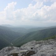
A voluminous network of trails spiderweb the mountains that surround Asheville. Soaring ridge lines, breathtaking views, and an epic array of terrain have long established this city as one of the hiking epicenters of the country.
The tireless efforts of such organization as The Carolina Mountain Land Conservancy and the Conservation Trust for North Carolina have not only protected the existing state parks and forests, but have been able to expand upon them by thousands of acres. From the heights of Mount Mitchell, the tallest peak on the East Coast, to the waterfall-studded trails of Dupont, to the sublime views of Max Patch, the outdoor opportunities in the Southern Appalachians are limitless.
Mount Mitchell

Hikers, backpackers, trail runners, and naturalists flock to the summit of Mount Mitchell not only for the beauty of its surroundings, but also because it is the highest peak East of the Mississippi. Towering above the Black Mountains, the views from the top are truly exceptional.
One of the best ways to reach this acclaimed summit is to begin at Black Mountain Campground on the South Toe River in Burnsville. The steep, thickly wooded trail climbs 3,600 feet in just over 5.5 miles. The forest transforms as you quickly gain elevation, a welcome distraction to the grueling uphill hike. When you reach an alpine meadow abloom with wildflowers, allow yourself a well deserved break, as the rigorous pace of the trail soon picks up again. Even experienced hikers will find this a strenuous, all day excursion, but the the reward of heavenly views and pristine mountain air at the summit are worth the effort.
When you arrive, take a moment to pay tribute to Elisha Mitchell, for whom the mountain was named. This scientist, explorer, and professor was the first person to measure the mountain and declare it the highest in the East. She is buried on the summit.
Shining Rock

Luminous with bright white quartzite rock, the summit of Shining Rock is a veritable gem of the Appalachians. In the Shining Rock Wilderness, high in the Great Balsam Mountains, miles of soaring ridgeline string together grassy balds laced with wildflowers and surrounded by ethereal views. Perched high in the rugged and remote wilderness, the quartzite garden atop the summit is a popular spot for star gazing.
Although a collection of trails leads to Shining Rock, the most picturesque of these includes a section of the Art Loeb Trail. Park at Black Balsam Knob Trailhead on Road 816 off of the Blue Ridge Parkway; head North and follow the white blazes of the Art Loeb Trail. You will reach the top of rounded summits, traverse five miles of spectacular ridgeline, and drop down mountain passes before reaching Shining Rock Gap. From there, scramble up a network of unmarked trails to the summit and watch the sunlight bounce off crystalline rock formations.
Dogs are more than welcome, and no fees or permits are required to hike or camp at Shining Rock. However, it is a designated Wilderness Area, so be aware of the specific guidelines that come along with that.
DuPont State Forest

In 2012, DuPont State Forest gained notoriety as the hauntingly beautiful backdrop of the smash blockbuster hit The Hunger Games. Before then, this 10,000 acres of wooded wilderness was best known for its abundance of waterfalls. The Little River cascades through the forest, careening over Bridal Veil Falls, Triple Falls, High Falls, and more. Eighty miles of meandering, multi-use trails and five cold water mountain lakes makes DuPont a hiker’s oasis during the hot summer months.
For a mellow and scenic excursion, check out the 4.5 mile trail leading up to Cedar Rock. It awards sweeping views without much elevation gain. If you’re up for something a bit more strenuous, both routes to the top of Stone Mountain, the highest point in DuPont, are steep and demanding, but offer gorgeous and far reaching views (and a lot less people than the popular waterfall trails). At the end of the day, take a dip in the expansive, 99 acre Lake Julia.
Linville Gorge Wilderness

Michael Sprague
The 12,000 acres of the Linville Gorge Wilderness Area are some of the most rugged and wild in all of North Carolina. Thirty nine hiking trails fan out from access points on the East and West Rims. Although the trails vary in length and intensity, with a few easier options on the rim, most carve their way steeply down to the bottom of the 1,400 foot canyon. Certain strenuous hikes will even cross the Linville River before marching sharply upwards again.
The beauty of this remote wilderness and its spectacular, long-reaching views cannot be overstated. Towering cliffs (often slung with ropes and dotted with rock climbers) and a thriving mixed hardwood forests surround you as you plunge deeper into the canyon. When the river is high, it is considered one of the best, albeit dangerous, class V whitewater kayaking runs in the Southeast. At lower volumes, you will have your pick of swimming holes, cliff jumping and small waterfalls to explore.
Backcountry camping is allowed in Linville Gorge. Between March 1st and October 31st, permits are required for weekends and holidays. You can find these at the Information Cabin on Kistler Memorial Highway or the Grandfather District ranger office in Marion.
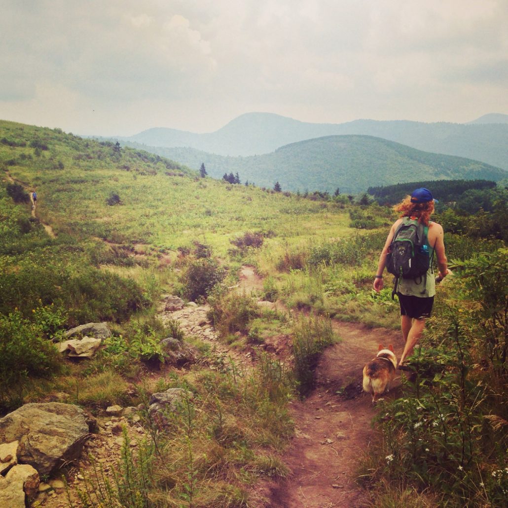
Max Patch

Roughly 20 minutes outside of Hot Springs, NC, Max Patch is one of the Southeast’s most acclaimed and spectacular viewpoints. This enormous, verdant meadow lies on the Appalachian Trail as it follows the crest along the border of North Carolina and Tennessee. The exquisite, panoramic skyline includes the Great Smoky Mountains, the Great Balsam range, the Roans, and the Black Mountains. In the evening, the sun bleeds purple fire over the rolling, expansive view of Tennessee to the West.
‘The Patch’ is a versatile destination enjoyed by day hikers, backpackers, Appalachian thru-hikers, and sightseers alike. Most of the 4,600 foot climb is accomplished by driving the long and winding access road; from the parking lot, the summit is just half a mile away. For a longer hike, explore the 2.4 mile loop which circumnavigate the meadow. If you prefer a bit more distance, just point towards Maine or Georgia on the Appalachian Trail and wander for as long as you please. For an easy adventure with a huge payoff, camp in the forest that runs alongside the bald. Be sure and wake up in time for sunrise.
Resources:
Organizations: Carolina Mountain Club , Conservation Trust for North Carolina , Carolina Mountain Land Conservancy
Retailers: Frugal Backpacker and Diamond Brand Outdoors
Originally written by RootsRated.
Featured image provided by Melina Coogan