Posts

The South Fork of the Mills is a rarely run gem in the heart of Pisgah National Forest. It features classic Western North Carolina scenery and good whitewater. It is the only stream around that lacks difficult and dangerous whitewater while draining a remote gorge. The area is also steeped in history. The put-in is only a few miles from George Vanderbilt’s Cradle of Forestry.

What Makes It Great

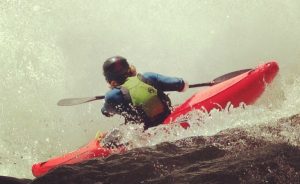
Paddlers will immediately notice the fantastic water quality of the South Mills due to the lack of development in the watershed. Drifting downstream, surprisingly good, pool-drop whitewater leads to an obvious horizon line. This is the sliding entrance to High Falls, a twenty-foot cascade that lands on a rock. Expert paddlers will find this waterfall intriguing at high flows, when the landing is padded.

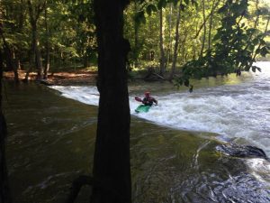
Below High Falls, South Mills continues to deliver fun ledges, never exceeding class III. Some scouting may be necessary, primarily to look for wood.

A spectacular rock wall on river right drops straight to the water about six miles into the trip. After the wall, the river slowly mellows out as it meanders toward Turkeypen, where most boaters will take out.

If the twelve mile paddle leaves you hungry for more, consider the car-less shuttle. Run back to your car on the South Mills Trail and then climb the Cantrell Creek Trail to Horse Cove Gap. Forest Road 5018 will bring you back to the put in. The twelve mile run climbs significantly and will take a couple of hours.

Don’t try to run or bike back up the entirety of the South Mills Trail. It will be flooded during good paddling conditions.

Who is Going to Love It

Strong class III boaters are going to have the most fun on the South Mills. The whitewater is reminiscent of Spring Creek in Madison County but the river is longer and more exposed due to the isolation of the valley. Class IV paddlers will not find the river particularly challenging, but will still enjoy the solitude and beauty of the drainage. High Falls will provide entertainment for even the most jaded hair boater. The multisport athlete is going to get the most out of this run. The trail run shuttle eliminates the need to spend several hours in the car. The running will be soggy, but the trails are some of the best in Pisgah.

Directions, Parking, & Regulations

From Asheville, take 280 South to FS 297 (Turkeypen Rd). This is the Turkeypen Trailhead and the South Mills takeout. Walk the half-mile trail down to the river to ensure you don’t miss the takeout. Return to 280 and turn south toward Brevard. In five miles, turn right on 276 North and follow it 11.5 miles to FS 1206 (Yellow Gap Rd). In 3.5 miles bear right on FS 476. Follow it to the dead end where you will see the river.

JOIN OUR NEWSLETTER

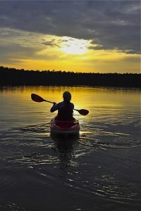
Featured image provided by Adam Herzog

A kayak or paddle board can provide years of great times on the water. Choosing the right one can be a challenge. In addition to free community demo days on the water (like Paddlefest at Lake Julian on May 6), we also offer our demo kayaks and stand up paddle boards for rent. Through April 30, our kayaks and SUP rentals are 50% off!

Kayak and paddle board rentals are available at our flagship location in South Asheville on 1378 Hendersonville Road. They are available on a first come, first served basis and are available for flat water, whitewater, and recreational water surfaces. A complete list of our boats is available below or here.

Kayak + SUP Demo Rental Prices

  • $12.50/day, Monday-Thursday (through April 30, $25/day after)
  • $20/day, Friday-Sunday (through April 30, $40/day after)
  • A paddle and PFD are included, based on availability.
  • If you decide to purchase a boat, we’ll deduct one day’s demo rental from the price!

You’ll need an ID and credit card to rent a demo kayak or paddle board. You’ll also need to sign a release form. Save time by bringing a filled out copy with you. We do not have racks or trailers for rent, but we do sell boat straps. For FAQs, click here.


Fishing Kayak Rentals

  • Native Propel Pedal Drive 501
  • Native Slayer Propel 10
  • Native Titan Propel 10.5
  • Native Titan Propel 12
  • Native Titan Propel 13.5
  • Native Ultimate FX 13.5
  • Native Ultimate FX 12
  • Native Ultimate FX 15
  • Native Slayer 12
  • Native Slayer 12 Pro
  • Native Ultimate FX 15 Tandem

Recreational Kayak Rentals

  • Liquidlogic Marvel 10
  • Liquidlogic Manta Ray 12
  • Liquidlogic Coupe
  • Liquidlogic Inuit 12.5
  • Hurricane Santee 116 Sport
  • Hurricane Santee 126 Sport
  • Hurricane Skimmer 120 Propel
  • Hurricane Skimmer 116
  • Hurricane Skimmer 128
  • Hurricane Skimmer 140 Tandem

Crossover (Whitewater/Flatwater) Kayak Rentals 

  • Liquidlogic Remix XP 9
  • Liquidlogic Remix XP 10

Stand Up Paddleboards

  • Liquidlogic Versa Board

Touring Kayak Rental

  • Hurricane Sojourn 146

JOIN OUR NEWSLETTER

Image for French Broad Paddle Trail

Imagine unloading your kayak or canoe and setting up camp on an island in the middle of a mountain lake. A brilliant Carolina sunset reflects on crystal clear water as you finish tying off your hammock. Or maybe you’ve reached a coastal oasis accessible only by your own paddle power. At night, you fall asleep in your tent to the relaxing sound of waves.

From the cool waters of Lake Jocassee to the brackish tidal swamps out east, the Carolinas are home to a huge variety of flat water paddling experiences. While many are accessible by day trip, some require a little more time. Here are seven of the best paddle-in campground adventures from the mountains to coast in the Carolinas. Start your adventure with a visit to the paddling experts at Diamond Brand Outdoors.

Cheraw State Park

Several trails offer an on-land option to explore Cheraw State Park.
South Carolina State Parks

Paddling through the cypress wetlands of Lake Juniper is an experience every flatwater boater should have, and at Cheraw State Park the experience couldn’t be easier. The $21 per night camping fee for the paddle-in sites comes complete with boat rental and the park even participates in a fishing tackle loaner program. All you need is your standard camping gear. If possible, time your trip during one of the park’s moonlight paddle outings and see the lake in a whole new light.

Devils Fork State Park

The crystal clear waters and minimally developed shoreline of Lake Jocassee have become a popular retreat in all seasons. Leave it all behind and paddle out to the seclusion of an island campground at Devils Fork State Park. Thirteen sites line the western edge of the island, providing an incredible sunset experience. Basic toilets are available but you’ll need to bring all the other comforts of camping with you — which is a small price to pay for such serenity.

Keowee-Toxaway State Park

Paddle-in campsites at Lake Keowee-Toxaway State Park offer amazing sunset views. Rob Glover
Paddle-in campsites at Lake Keowee-Toxaway State Park offer amazing sunset views.
Rob Glover

Lake Keowee is an oft overlooked gem in South Carolina. Just a few miles from its larger cousin Lake Jocassee, the gorgeous surrounds and cool, calm waters of Keowee offer an amazing respite after a long work week. All the sites at the small and quiet campground of Keowee-Toxaway State Park are a pleasant stroll from the lake, but three sit right on the shoreline. You can walk to these sites, but the two-ish mile trek can create a logistics problem when toting all the trappings of a great camping weekend. Instead, load up your canoe and paddle to the site just short distance away from the park’s boat launch.

Hammocks Beach

Tucked between huge dunes, Hammocks Beach State Park’s paddle-in campground feels both hidden and open to the entire universe.
North Carolina State Parks

Reaching the row of waterfront campsites on Bear Island requires first paddle across the intercoastal waterway and through the reedy waters of a coastal swamp. What awaits is a pristine, white sand beach buffeted by large dunes and an unfettered view of ocean and sky. Hammocks Beach State Park, which encompasses Bear Island, offers a convenient launch site as well as boat rentals. The campground is rugged but includes showers and bathroom facilities.

Lake James

Perhaps known more for its super flowy singletrack or uber popular lakeside picnic facilities, Lake James State Park is also home to 30 boat-in campsites. These simple sites include only the basics: fire ring, tent pad, and picnic table. While you’ll have to bring in everything you need, including your water supply, a sunrise paddle on the tree-lined lake is well worth the effort. The closest launch to these sites is at the main visitor center in the Paddy’s Creek section of the park. Here they rent kayaks, canoes, and paddleboards — but they go fast. Call ahead to check for availability or bring your own.

Merchants Millpond State Park

Weaving through immense cypress trees at Merchants Millpond is an experience every paddler should have.
North Carolina State Parks

Designated paddle trails in Merchants Millpond State Park flow alongside dense hardwood forests and through stands of immense bald cypress trees. Just beyond the millpond, Bennett’s Creek runs slow and shallow through the low-lying Lassiter Swamp. A water-level exploration of these fascinating biomes is best begun from one of the state park’s paddle-in campsites. The sites are primitive, with only pit toilets available, but the park does offer canoe rentals.

New River State Park

Not only is the ironically named New River one of the oldest in the world, it is among the most natural and interesting to explore. In recognition of these properties, the New, which runs through the Blue Ridge Mountains in the northwest corner of North Carolina, is a federally designated Wild and Scenic River. A multi-day exploration of this tree-lined waterway can be done Deliverance-style (minus the, well, you know) by way of multiple canoe-in campsites managed by New River State Park. The paddle trip to these primitive campsites is a serene and scenic experience. Although the flow is calm here, it’s important to either know the river; less experienced paddlers should contact Ashe County for a list of local river guides.

JOIN OUR NEWSLETTER

Featured image provided by North Carolina State Parks

The French Broad is one of the world’s oldest rivers and one of the most important natural assets in Western North Carolina. In 2012, the 140-mile-long French Broad River paddle trail was completed, improving recreational access with eight paddle-in-only campsites every 12 to 15 miles. Environmental nonprofit MountainTrue developed and oversees the trail and is home base for Riverkeeper Hartwell Carson. Each year the group hosts the French Broad Riverkeeper Float, a multi-day river adventure guided by Carson for fun and education on the river and the environmental issues surrounding it. MountainTrue provides boats for those who don’t have them and supplies all meals; just show up with a tent, jump in a boat and you’re off.

Boaters on the French Broad, Courtesy of Joanne Sullivan
Boaters on the French Broad (Courtesy of Joanne Sullivan)

The trip’s support team arrives at each stop in advance and gets meals set up and takes care of breakfast in the morning, too. The trip attracts people of all ages (kids are welcome) and it’s designed to be easy enough for newbies to paddling.

What sets the trip apart from solo adventures is the opportunity to get a behind-the-scenes look with the person who probably knows more about the river than anyone else. Carson has been the French Broad Riverkeeper for years, immersed in its ecological and political issues. Participants in the float learn about the effects that a industrial plants along the river have on water quality and may do a water sample along the way.

Paddling the French Broad Paddle Trail, Courtesy of Save the Float

Paddling the French Broad Paddle Trail (Courtesy of Save the Float)

The Float includes a paddle through Biltmore, as well as stretches of flat water, rural, urban, and remote parts of the river. There are small areas of class II and III rapids along the route, but nothing too challenging. There’s no shortage of outfitters along the French Broad, but the Float offers a unique experience that combines education, fun, and food along the water.

JOIN OUR NEWSLETTER


Featured image provided by David Wilson

The Green River is a place that has had a large influence on the world of whitewater paddling and on many boaters’ lives. It is a highly convenient run because of its proximity to Asheville, Greenville, Charlotte, and Atlanta. Since it is a dam-released river, it also runs 300+ days a year.

Add the fact it has three sections of varying difficulties (and one of the most famous and prestigious extreme races) and you start to see why it is beloved by so many. But the truly beautiful thing about the Green is the combination of all these conveniences with an authentic wilderness experience. As soon as paddlers slip into her waters, the Green has a way of softening the sharp corners in life, and re-centering the soul.

What Makes It Great

Upper Section:

The Upper Green is a fantastic run for the class III paddler who is looking to dip her or his toes in the realm of vertical drops. Paddlers are treated to several miles of nice winding class II and III rapids and two borderline class IV drops. Notable named rapids are Bayless Boof, Wanda’s Hole, and Pinball. Take out just before Big Hungry Creek enters on the left and hike the half mile uphill to civilization.

Narrows Section:

The Narrows is arguably the most famous steep creek in the world. With a nice combination of boulder garden and bedrock rapids, this section will challenge and push the most elite of kayakers, but is also accessible (with a few portages) to the class IV+ boater. Go Left and Die, Gorilla, and Sunshine are the three major class V rapids, and there are many more drops that aren’t to be trifled with. The majority of the gradient is concentrated within the “monster mile,” which drops at a rate of 300+ feet per mile. This section lends itself well to multi-lap days.

Lower Section:

The Lower Green is the perfect beginner run. The truly bipolar river lets go of its furious descent and meanders out into a beautiful rural valley. This is a perfect section for the beginner paddler or a summer tube trip. It is completely roadside, so choose how much of the 7 miles you’d like to bite off.

Unique Experiences

Dawn Patrol:

Set shuttle in the dark and put on at first light for an unforgettable experience or great start to the work day!

Heron Viewing:

There are several Great Blue Herons that enjoy fishing the Green. On lucky days, you can quietly follow them down the river as they fly from one fishing spot to another.

Racing:

The Green Race is an experience unlike any other. For those with the skills, paddling down that incredibly challenging course and into a 1,000+ spectator amphitheater at Gorilla is something that belongs on the bucket list. This event always occurs the first Saturday in November. The Narrows get much more intense during the weeks before the race, and this is not a good time for a first-time paddler.

Disclaimer:

Please paddle within your abilities. Paddlers who step above their abilities are very easy to spot and actually endanger river access for all.

Directions, Parking, & Regulations

Access Directions:

  • Upper Takeout: From Asheville, take Interstate 26 East to Exit 22 (Hendersonville/Upward Rd). Take a left onto Upward Rd and drive 1.5 Miles and follow Big Hungry Road to Gallimore Road. Park in gated lot (see below for key info).
  • Upper Put In: From Gallimore Road/Upper Takeout, return to Interstate 26 to Exit 23 (Greenville/225/176/25). Drive 1.8 miles to Exit 176 (Saluda/East Flat Rock), turn left onto 176 and drive 2 miles. Make a left onto Pot Shoals Road. Park on the downstream side of Pot Shoals Bridge.
  • Narrows Takeout: From Asheville, take Interstate 26 East to Exit 59 (Saluda). Make a left off the ramp onto Green River Cove Road. Fishtop Access is a large gravel lot at the bottom of the hill.
  • Narrows Put In: From Asheville, take Interstate 26 East to Exit 22 (Hendersonville/Upward Rd). Take a left onto Upward Rd and drive 1.5 Miles and follow Big Hungry Road to Gallimore Road. Park in gated lot (see below for key info).
  • Lower Takeout: From Asheville, take Interstate 26 East to Exit 59 (Saluda). Take a left off the ramp onto Green River Cove Road. Note the Fishtop Access gravel lot on left at the bottom of the hill. Drive an additional 6 miles to theBig Rock Take-Out gravel lot on left.
  • Lower Put In: From Asheville, take Interstate 26 East to Exit 59 (Saluda). Make a left off the ramp onto Green River Cove Road. Fishtop Access is a large gravel lot at the bottom of the hill.

Important Info:

  • River Gauge: A few rapids below the Narrows put in, you will find a stick gauge. A good minimum on this gauge is 6″. A healthy 100% flow is 9″ and 17″ is 200%. Paddlers have ventured into the Narrows at up to around 36 inches, but the consequence factor becomes exponentially larger as the water goes up. Also, please note that there is no alcohol within 50 feet of the river.
  • Water Schedule: Since this is a dam-released river, it’s important to understand water schedules. 
    • Water to Upper Takeout/Narrows Putin (2.5 hours)
    • Water to Narrows Takeout/Lower Putin (4.25 hours)
    • Water to Lower Takeout (6.5 hours)
    • Water empties faster than it fills. Don’t put in at the Narrows more than 1.25 hours after the dam shuts off.

JOIN OUR NEWSLETTER

Featured image provided by Melina Coogan

Image for Green River

Primarily a popular whitewater rafting destination, the Pigeon River is a dam controlled river that winds its way through North Carolina and Eastern Tennessee before emptying into the French Broad River.

What Makes It Great

Situated along the Smoky Mountains, the Pigeon River provides beautiful views as you make your way. Paddlers along the Upper Pigeon will brag about the famous whitewater encountered — Roller Coaster, Powerhouse, Lost Guide, and many more that will keep your energy high and your skills tested. The Lower Pigeon provides a much better experience for the paddler wanting to become more comfortable with intermediate whitewater, with many calm sections and rapids from class II/III.The Pigeon River has impressively overcome quite a bit of environmental damage over the last two decades. It used to be an extremely polluted waterway with rapidly decreasing biodiversity, but now it has healthy fish populations (which anglers take advantage of) and a growing recreational presence.

Who is Going to Love It

For thrill seekers and more experience paddlers, you’ll want to choose the Upper section of the Pigeon because it has a lot of fun play spots and about five miles of Class II-III+ rapids. For novice paddlers or those simply looking to soak up the scenery, the Lower section of the Pigeon provides four miles of family friendly flat water where swimming is encouraged.

Directions, Parking, & Regulations

Public access along the river is primarily limited to bridge crossings and small pull-offs along the roads paralleling the river. There are a few primitive launching areas for canoes and other small boats.For the Upper Pigeon- Parking can be found by taking I-40 to exit 451, taking the bridge and turning up river. Take Waterville Road and you will see a parking area/put it. More information can be found here. For the Lower Pigeon, head towards Hartford, and park at any of the put-ins near the rafting outfitters.

JOIN OUR NEWSLETTER

Featured image provided by Jared

Events

Nothing Found

Sorry, no posts matched your criteria